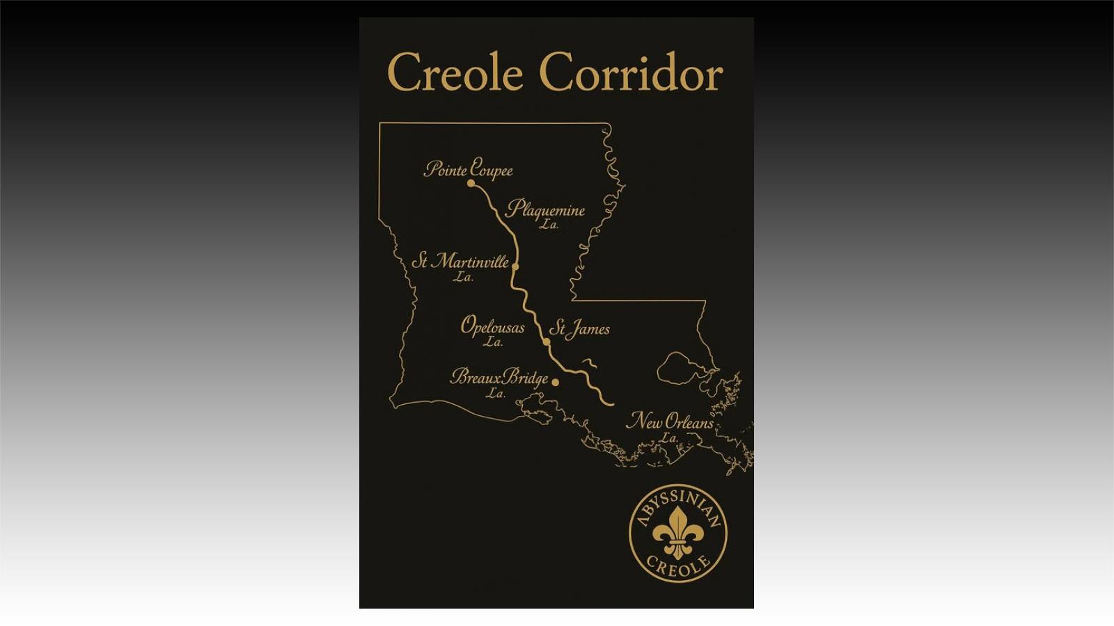
From New Orleans to St. Martinville, from Plaquemine to Pointe Coupée — this is not just geography, it’s a living memory.
The Creole Corridor is the ancestral highway of our people. Along the Mississippi and the bayous, families carried language (Kouri-Vini), faith (Catholic but uniquely our own), and culture (music, food, memory).
New Orleans was the port.
St. James & Ascension were the sugar country — the plantation belt, where pain was deep but Creole roots endured.
Plaquemine & Pointe Coupée held the river towns.
St. Martinville, Opelousas, Breaux Bridge carried the heart into the prairies.
Every stop speaks to survival, resistance, and the brilliance of Creoles of Color who built, prayed, taught, and played along this line.
This map is not just history — it’s heritage restored.
- Se connecter ou s'inscrire pour publier un commentaire
- 47 vues

03/07/2026 - 18:48
Lény-Huyayna Tible ("Zinfos 74")
15/06/2026 - 21:10